
Earlier this year I was trying to decide what races I wanted to do. Nothing I saw really inspired me though and while chatting with my wife Fiona one morning the idea of running the Southern Uplands Way was born. At the time I didn’t know that there was a race along the route too. I only found this out when I started to research the idea in a bit more detail. I also wasn’t sure by what means I wanted to complete it. I was quite surprised when looking at maps how remote the route was in places; finding places to stay wouldn’t be easy. Initially I wasn’t too keen on staying in bothies as it would require carrying more kit. I’d only done one 2 day fastpack so far which was in the Cairngorms last year with Fiona and included a tent.

The entire route
The Southern Uplands Way is a 212 mile (355km) long distance walking route from Portpatrick on the south west coast of Scotland to Cockburnspath on the North Eastern tip of the Scottish Borders. It is one of the widest West-East stretches across Scotland. To give you a sense of how far west the route starts: When crossing the M74 motorway which is the Western Road link between England and Scotland you are already over half way along the route.
The Southern Uplands Way website does feature suggested distances and includes places to stay off the route where accommodation owners pick walkers up to take them to their overnight stay. I didn’t fancy that. I wanted to use my own 2 feet to move forward from the moment I left the start at Portpatrick until I reached the finish. Thus I wanted to ensure that my overnight stays would be as close to the route as possible, ideally on the route. The bothies therefore became a must. After initially rejecting them I started to relish the idea as they added to the adventure.
Fiona’s parents live in Dunbar which is roughly 10 miles along the coast from the finish of the Southern Uplands Way with the John Muir Way Link path running between them. The Southern Uplands Way finishes in the village of Cockburnspath which has very few amenities and just as many transport links (apart from being on the A1). Adding the link up to Dunbar seemed to make for a more suitable finish. More than that, I was going to finish there on Fiona’s birthday to add extra impetus to the final day.
Looking at the mileages and the possible overnight stops I had concluded that I would attempt to do the route in 8 days including the extra 10 miles to Dunbar. Walkers typically complete the whole route in 2-3 weeks. I would stay in hotels (1 night), B&Bs or similar (4 nights) and bothies (2 nights). The chosen distances per day varied from 35 km (22 miles) to 64 km (40 miles).
Some of the route I knew as it goes through the Scottish Borders towns and therefore the route leading from St Marys Loch to Traquair, onto Galashiels, Melrose and then to Lauder and into the Lammermuirs I had been on at least once on a bike with most of that in a multiday bike packing trip in 2018 along the Capital Trail.
The route further west though I had no knowledge of except for what the map, the SUW website and the SUW Facebook page would reveal.
It was going to be an adventure of an unknown dimension which made it exciting. It has been a while since I have started something where I wasn’t entirely sure if I would be able to finish it. Rather remarkably, I can’t claim to have specifically trained for this but went into it off the back of my generally pretty strong fitness.
In the weeks leading up to this I had been in the Pyrenees in May for the annual training camp I organise through DeZeiner Fitness which involved a large volume of cycling; Fiona and I spent a week in Northern Scotland bike packing and Munro bagging in June; we spent a weekend in Glen Affric running up and down mountains and along the glens (that weekend I did my first test run with a full heavy pack covering 30 km in poor weather conditions), and I did the Scafell Pike Trail marathon a week before the Southern Uplands Way Run.
The trail race was my longest run of the year and I felt somewhat unsure about doing back to back 40 mile days on the Southern Uplands Way with a heavy pack after already having done 2 days leading up to those.
The week was due to pan out like this:
Day 1: Portpatrick to New Luce (planned distance: 34.2km; planned ascent: 682m)
Day 2: New Luce to White Laggan Bothy (47.9 km; 1110m)
Day 3: White Laggan Bothy to Sanquhar (64.1 km; 1602m)
Day 4: Sanquhar to Over Phawhope Bothy (60.8 km; 2419m)
Day 5: Over Phawhope Bothy to Innerleithen (38.9 km; 928m)
Day 6: Innerleithen to Lauder (47.1 km; 1386m)
Day 7: Lauder to Greenhope B&B (32.5 km; 840m)
Day 8: Greenhope B&B to Dunbar (36.2 km; 740m)
The main items my pack contained:
Spare clothing (long and short), spare underwear, running poles, waterproofs, hat, gloves, sleeping bag, sleeping mat, stove, pan, power bank, some food for the journey, first aid kit, map, coffee mug, 2 soft flasks, food for the bothy nights (couscous, rice, porridge and coffee), plus a couple of other bits. The pack weighed in at around 6.5kg. It felt heavy. This was more than 10 % of my body weight.
Getting to the start
I left Edinburgh at 11am on Saturday morning (July 13) to travel to Stranraer on the Belfast bus and then change there for a 20 min hop to Portpatrick. Total journey time from Edinburgh to Portpatrick was a touch over 5 hours and I missed out on seeing the Skiffie world championships in Stranraer.
I got to Portpatrick on a lovely late summer afternoon with vintage trucks rolling on for that weekend’s vintage commercial vehicles rally. It made for a buzzing town that evening.
The Harbour House Hotel put me up for the night in a lovely top floor room in their annex.
Day 1 – Coast

Ready to go
The morning of day one was even nicer than the evening before as the wind had disappeared leaving a ripple free sea and a cloudless sky. 

After a hearty breakfast in the hotel and adding a random selection of sandwich, apple and crisps (their lunch pack) to my pack, I set off. 230 miles lay ahead of me and the East Coast. The first few km along the coast north of Portpatrick are stunning coast line, although not fast under foot. I stopped on one of the beaches to pick up a pebble to carry to the North Sea.


When I got to Killantringan Lighthouse the route started heading away from the coast. From here I was on a mix of road, farm track and to a lesser extent single track across towards Stranraer and then onto the grounds of Castle Kennedy.
All of this was pretty low land with fields and forests. After Castle Kennedy the route left the lower ground and lifted to some moorland at around 140m before then dropping through forests to New Luce. The official route bypasses the village of New Luce but my accommodation was in the village so I would do 2 sides of a square that weren’t part of the route.

Picking up a pebble
I stopped to eat my packed lunch in some woodland before reaching the grounds of Castle Kennedy. I regretted taking this from the hotel as it added unnecessary extra weight. On the climbs in particular I was aware how heavy the pack felt. I’d run descents and mostly on flats too but none of this was fast. It was a shorter day and I had no time pressure. As the place I’d booked was more likely expecting a walker taking a few more hours than me, I was aware of the potential of arriving too early.
Rainbow’s End
There was a bit too much tarmac for my liking that day. The best part of the day was the coastal path up to the lighthouse. The descent into New Luce was in some parts good too although just before getting back onto the road into New Luce I had my first (of numerous) cow field encounters of the trip with a rather more active herd than I would have liked.

Leaving the Irish Sea behind

Day 1 route map
By chance just as I got onto the road the owner of the place I was due to stay at drove past and offered me lift which I declined. Clue, I was running early. She then said she’d expect me in around 40 min. As it was about 2k to New Luce, I was more thinking 10-15 min. It took a while when I got there for her to grasp that I’d run from Portpatrick in only 6 hours for 35 km. 
I’d found Rainbow’s End – where I was staying in New Luce – on the Southern Uplands Way website. Celia offers B&B and dinner as the hotel in the village closed recently and there is nothing else in the area. Rainbow’s End felt more like a homestay. I got most of my accommodation choices from the SUW website with the exception of Portpatrick (although the Harbour House Hotel is listed there too but I booked through booking.com) and Innerleithen (also booking.com). The SUW website lists hotels, B&Bs, homestays, campsites and bothies along the route which is a very useful service to have.


Celia cooked a whole slow chicken for dinner (plus starter and deserts). Even though I’d run for 6 hours and covered 35k and had another big day ahead of me the following day a whole chicken was a bit extreme. I think it would have been the same amount of dinner if there would have been more of us. As I’d finished my run before 4pm I had time to relax, take stock and prepare for the next day. My feet and calves felt a bit battered due to the harder than expected surfaces.
I enjoyed the warm weather with temperatures in the low 20 Cs.
Distance: 35.42km; Vertical Ascent: 608m; Elapsed Time: 6:24hrs
Day 2 – forests and wind farms

I didn’t sleep well and that was to be a pattern throughout the week but I also woke feeling keen to get on with it. Over breakfast though I noticed how nervous I was, similar to the start of a race. I had none of that the previous morning. With 48km it was to be a bigger day than the opening day, the longest run since Jedburgh Ultra 2018 and the start of a particularly big 3 day block of 48/64/60 km distances. Although I can’t be sure these seem likely factors for the nerves. I tried to wolf down my fry up breakfast and get on the road. To Celia’s surprise, I declined the lunch pack but wanted 2 slices of the walnut plum banana loaf that was part of desert the previous evening. I thought that would be great for my lunch stop.

The route from New Luce to White Laggan Bothy can be split into two halves. The first after a bit of farm and moorland was mostly forests and windfarms. This probably covered nearly 20km with a fair bit therefore on big forestry work tracks and some in high grass through the fire breaks. The 2nd half was the approach to and getting in to the hillier country around Loch Trool which made for much more exciting landscapes and a great finale to the day after a rather monotonous early part.
Hitting the Deck

Beehive Bothy
Somewhere along one of the forestry tracks I tripped and hit the deck quite hard. I had already done similar on the first day and got some scrapes on my shin. This time I had quite a cut on my knee. These 2 alongside a few near misses didn’t fill me with confidence. Due to carrying my heavy pack I wasn’t lifting my knees much and thus shuffling along the ground much more risking clipping even just the slightest unevenness. The added problem with the pack was that when I had tripped I’d quickly lose my balance and fall whereas in normal circumstances I’d easily catch that before I went down. I had to be more vigilant otherwise I’d do myself some serious damage.
Earlier that day I started using my poles, not to stop me falling but to help with the climbs. I did wonder if they would help with balance too which for a while they did until I did manage to hit the deck again on the 3rd last day, with surprisingly no scratches to show thankfully.

Once I started using the poles they never went back into my pack. If going downhill I’d just have them in one hand and run, walking uphill I’d double pole and on gentle gradients I’d single pole while running. This added some impetus to my forward motion.
The weather that day started out sunny and warm. Going through the forests and windfarms it had clouded over and got windy, to add to the monotonous nature of the area. Once out of that the sun came out again for a very warm afternoon. I had earmarked the Glentrool visitor centre as a stop for a coffee and maybe cake, so I allowed myself a deviation from the Southern Uplands Way and headed up the road through Glentrool village and to the visitor centre. Although I wasn’t on the route there was a nice gravel track next to the road. The coffee and a large glass of water were very welcome. I chose not to have any cake (or ice cream) but stopped at a stream a bit further along the route to eat my 2 slices of banana bread.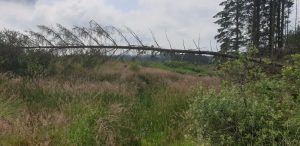

Potentially one of my other reasons for being nervous that morning was that I wanted to make sure that I got to the bothy in good time, or maybe I wanted to make sure I got to the visitor centre before it closed. I am not sure why really. From leaving the Visitor Centre I’d relaxed on that front, maybe earlier already, as I was then happy to sit by the stream and then found another one to cool my legs in before I started the final climb from Loch Trool over to Loch Dee and the bothy. The area around these 2 lochs is stunning especially on a beautiful summer afternoon. It was warm with the temperatures in the 20s again.
Bothy Life

Day 2 route map
I got to the bothy around 5pm hoping to have it to myself. No such luck. I got to share the bothy with another guy who was walking the entire Southern Uplands Way route. He was having a lie down when I got there as he was exhausted from the days walk in the heat. I probably didn’t help by being all bouncy and chatty and not sounding particularly like I’d just done 30 miles. He had started his day in Bargrennan and covered around 13 miles to get to the bothy. It would take him 3 days to cover what I was going to do the next day. This put into perspective what I was doing in comparison. Also worth noting though was the difference in pack sizes with his probably being 3 times the size of mine.

Dinner for me started with cup of chicken noodle soup followed by couscous with beef jerky washed down with a nice cool can of Tennent’s beer. The fun thing of bothies is that you never know what you might find. After I arrived I went to the stream which was within 10 paces from the bothy to fill my flasks. I was surprised to find 4 cans of Tennents cooling there and thought they must belong to the walker. I asked him and as he hadn’t been to the stream yet and hadn’t spotted the beer. To whoever left them: Thank you! One would have been enough though.

The bothy is located just off Loch Dee in an area known for star gazing due to the dark skies the area has, which gives you an idea as to how remote this place is. There are 3 star gazing ‘chairs’ there for you to comfortably sit in and keep your eye on what’s happening above. I spent a bit of time on them chilling as walking guy had already headed off to bed. It was only 8pm.
After a night cap of whisky (also left behind by a previous visitor) I also headed to bed for a second restless night not helped by snoring from below.
Distance: 48.5km; Vertical Ascent: 927m; Elapsed time: 9:23 hrs; Moving Time: 7:40 hrs

Day 3 – hot and dehydrated
I got up just after 5am just after snoring guy (his name is Aaron) got up. I had always intended an early start as I felt I needed to get going to cover the 40 miles on the plan before the dinner options in Sanquhar would close.
Before I started the trip I’d set an arbitrary pace target of 6 kph which was based on how long it took me to cover the test run I did in Glen Affric in May. It would allow for a bit of stopping, slowing down for uphills etc. On day one I was slightly ahead of that target and on day two roughly on target, falling a bit behind towards the end as I allowed for sitting around streams and the visitor centre. 6 kph for day 3 would mean around 10.5 hours to get from the bothy to Sanquhar. Apart from an extra 16km on the previous day there would be an extra 500m of vertical (1600m instead of 1100m). I left the bothy around 6:30am just after Aaron did. Breakfast was just a coffee and a Chia Charge bar – I was planning on 2nd (proper) breakfast in St John’s Town of Dalry (about 20km down the road/path).

Morning 5k out of White Laggan bothy
Based on that departure time and perfect progress I’d be in Sanquhar by 5pm. I was thinking 6-7pm to be more realistic and still well inside a time to allow for dinner purchase. That said, I felt under time pressure but not nervous as I guessed I could let it slip to 8pm in the worst case. 
The morning was a bit hazy but very calm and already a bit warm. The first 12km was on logging truck forestry tracks with – surprisingly – some traffic. Then some nice single track followed by a tarmac road down to St Johns Town. Start of day 3 was a pace blast. I was well up on schedule when I came into St John’s Town. Unfortunately there was no café as I had hoped for but I managed to get a coffee in the village shop. No 2nd breakfast then.
Things went downhill from here as trail conditions slowed things down, the heat took its toll and I eventually started running out of water. By St John’s Town I’d already done 24km, so over a third of that days distance and it was only 10am. I am not a fan of running on tarmac but that day I started looking forward to the tarmac sections as these meant faster forward motion. Once I’d spent some time on a tarmac road though I was again looking forward to the trail even though I couldn’t run it. If not running with a pack I think a lot of the trail I felt was difficult wouldn’t really have been. I was also covering some ground where it wasn’t all that easy to decide where the trail actually was.

Navigation
Navigationally this part of the route could be a challenge in poor weather conditions. Thankfully the weather was great from that perspective even if it was the hottest day of my week on the trail. I had a physical map with me which I never looked at – a Harvey map. I also had the entire route mapped out on OS maps on my phone via the Viewranger app which I can use in flight mode/offline mode while still getting my GPS location. So any uncertainties were always quickly answered and elevation and distance data was pretty accurate too.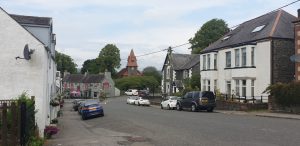

Dehydration

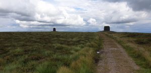
Striding Arch by Andy Goldsworthy on Ben Brack
The highest point of the day was Ben Brack at 580m about 2/3rds into that days run. 2-3 hours before reaching that point I’d run out of water. Most people would have run out of water by St John’s Town based on the amount of water I was carrying. I started the day with 1 litre and probably had my last sip of water around 1pm. The only other drink I had was coffee at the start of the day and coffee in St John’s Town. It is worth noting that I do have the ability to travel with very little liquid. I used 1 litre on day 1 (in around 6 hours) and less than 2 litres on day 2 (in around 8.5 hours). I always expected to need to refill during day 3 but finding water turned out to be an issue as either the water was too low in the valley and thus too much livestock around or the high ground just didn’t have any running water on it. When I did run out there wasn’t much I could do about it than to keep moving forward and hope some water source would come about at some point. Finally after descending Ben Brack (I had checked the map to see if there was something available soon but wasn’t sure) there was a decent stream and judging by the imprint in the grass around it I wasn’t the only person having made use of it. I filled my flasks, drank them and filled them again and off I went with renewed vigour to cover the last 10 miles into Sanquhar.

Day 3 route map

The day started with cows just as I hit the road down to St John’s Town and finished with cows for my descent into Sanquhar at which point a huge herd of cows sitting on the path really wasn’t welcome. I made a rather large detour around them.
The best part of the day was the early morning start with possibly a sighting of a golden eagle as well as summiting Ben Brack catching a view of the highest point of the entire SUW (for the following day). Worst parts were the cows and the dehydration. When I rolled into Newark Farm B&B – attached to a working farm – I was pretty done in, as Fiona can attest from the phone chat we had later that evening. I was still dehydrated and thankfully didn’t need to leave the B&B again to get dinner. Frances, the owner called in a huge fish and chips and a can of Tennent’s (theme here) for me. The Tennent’s didn’t come so she got one off her son. I know it isn’t ideal for rehydration but it was very welcome. I had downed several glasses of water beforehand and had some tea. I had a nice big room with a private bathroom and could therefore have a bath. A good end to a pretty tough day.
I knew from the forecast going into that day that it was likely to be the hottest. The following day was due to be cooler and had the possibility of rain. I was looking forward to both.

You might be wondering what I ate during that day: cliff bars, chia charge bars, shot bloks, jelly babies. Probably around 1500 cals for the entire day. It was a long day, a long distance but not high in intensity. So not much different to a big day’s hill walking.
By the end of the day I was very fatigued, with an interesting prospect of another 40 miles the following day with well over 2000m of climbing.
Distance: 66.89km; Vertical Ascent: 1527m; Elapsed Time: 12:51 hrs; Moving Time: 10:54 hrs
Day 4 – Into the mist
I’d asked Frances if I could have an early breakfast so we agreed on 7:30am and I got a cooked breakfast before heading out of the door. 3rd night done and another poor night’s sleep. I am putting this down to the body not being able to go to sleep after the hard work of the day and the late finish of the day. I am yet to sleep well the night after a long race such as an Ironman so this fits the bill but I thought after 3 days on the road/trail I’d just drop off especially after that 40 miler.

Tea Room in Wanlockhead Mining Museum

Anyway, out the door I went just after 8am. The hills I could see the previous day were shrouded in mist and although cooler the temperatures were probably still in the higher teens. Within the first km I got a twinge in my lower back which was a bit of a wakeup call. 18 months ago my lower back seized up to the extent I could hardly move.
Spasms

Lowther Hill with no views
Over the first 3 days physical aches and pains were noticeable but not particularly challenging (except hitting the deck). My feet and ankles would hurt from the pounding, my calves ached from the flatter sections, my hips were a bit sore at times, I got a bit of chafing on my lower back and my inner thighs which I expected. My knees also started hurting on the descents. All of these caused some discomfort but nothing to be concerned about and receded at the end of the day with little to no sign of them at the start of the next day. The chafing was looked after with Vaseline. Hips and lower back was no surprise due to the weight of the pack and the other aches were a result of the volume and the partly hard surfaces I was on.
The spasmic pain in my back and hip on start of day 4 was more worrying though. I did finish every day with some stretching but used numerous opportunities on day 4 to manage this issue, stretching glutes, hips and lower back. As the day progressed it was clear that the issue would be manageable. I did cause Fiona some worry with the news of this though on top of the fatigued call the previous evening.

When I’d initially planned the route and the back to back 40 milers I was happy with that idea. As the week drew closer, I was getting less convinced and started thinking up contingency plans allowing for Day 4 to be shorter and Day 5 to be longer. I had in my original planning missed a bothy which would be just over 20 miles into the day at Brattleburn. If I stayed there though day 5 would be a good 40+ miles long. Moffat was not too far off the route but around 30 miles into Day 4 so could be a further option for an earlier overnight. My thought before going into Day 4 was to see how I felt at each of those points and turn in for the night if need be. Moffat would have had the risk that there may not be any accommodation but midweek this seemed somewhat unlikely.
Back Ups

Ettrick Head with hardly a view
These back up opportunities were one of a number of positives going into the 2nd 40 mile day. The prospect of cooler and potentially wetter weather helped too as well as the lack of pressure to get to my final destination of the day. I was heading to a bothy if I was going to go the distance for the day, so I was happy to even arrive there after 9pm even though earlier would be preferred.
At the end of day 3, I definitely felt I was heading to one of the earlier overnight stops on Day 4. The message to Fiona in the morning about the back spasm made her believe this too. As I said earlier I managed the back pretty well as the day went on and pretty early on in the day the likelihood of an early overnight became a distant notion.
It is worth noting that not only was this to be the 2nd 40 mile day (4 km shorter than the previous day) but more importantly it was to have well over 2000m of climbing in it, over 700 more than the previous day. I’d be going over Lowther Hill at just over 700m which is the highest point on the entire route and around 3km from the day’s finish I’d go over Ettrick Head at around 550m. These things understandably added to my apprehension as I had to expect from the time that the previous day took that this one had the potential to be even longer.
No Views
The summit of Lowther Hill is inside the first 17km of the day and 2/3rds of the way to the summit I came through the old mining town of Wanlockhead which has a nice café in the mining museum. So that was my first target of the day for coffee and cake. I had made good progress to here. Approaching Wanlockhead the first of the day’s rain started and over the course of the afternoon a number of lengthy showers came through with some dry spells in between. I summited Lowther Hill with no views but also with no issues with navigation. There are enough way markers to keep you on the right track as long as the low cloud isn’t too dense.
On the descent to the A702 crossing I overtook a couple of long distance walkers. They were numbers 4 & 5 of long distance walkers that I met on the route. There was the guy in the bothy, I over took one person early on on day 2 and had someone come towards me just after my dehydrated water refill on day 3. After day 4 I saw no further long distance walkers until heading towards Longformacus on Day 7 when I saw another 2. Apparently roughly 600 people walk this route on average per year. My sightings were below that average number. The few other people I saw on the route will hardly take the number of trail users to more than 20. It is therefore no surprise that the path in places isn’t that well visible.

Day 4 route map
Soon after the A702 I passed a surprising but significant milestone for the route. The halfway point marker. Felt good. The day’s route seemed to go much more fluent than the previous day. Coming past Daer Reservoir was an impressive sight and running along the dam was fun. Beyond that the route went up high again and the reservoir stayed in view for a long time before the route dropped into forests which were in part being taken down. The route here was very overgrown and I passed Brattleburn bothy without even checking in on it. The rain was getting more persistent now. From entering the forest to the start of the climb to Ettrick Head the route is not particularly inspiring but it allowed for pretty fast progress except when blocked by cows. Passing under the M74 motorway gave me a sense of getting onto the Eastern part of the SUW. From here I had another 15km to the bothy. This would have been my other opportunity for an early overnight. I didn’t even give it a second thought but instead continued into the steadily falling wet curtain. I felt OK and time was fine too. I was hoping for an ETA before 9pm. A big Land Rover track led up the early part of the climb (I opted against the high level route as there wouldn’t be any views anyway). The Land Rover tracks gave way to single track in a forest. I was being accompanied by wind and driving rain but the temperatures still remained fairly warm. The top of the climb though didn’t want to come. Every time I thought ‘It must descend from here’, it didn’t. Finally a brief view in the mist of a big drop to my left with 2 valleys running away and soon after the start of the last 2.5km down to the bothy.
I was looking forward to my 2nd bothy night, being a bothy that I’d have to myself which I thought midweek on such a remote route would be highly likely. No such luck – again. A dad and his 2 teenage daughters were spending the night there (they parked a mile down the road). The benefit of this was that the fire was on when I got there, at 9pm on the button. I cooked my dinner, got dry clothes on and stunned them with the news that I had run there from a place 40 miles away. The girls in particular couldn’t grasp it. This was mostly a familiar story with my overnight stays, some of the B&B owners had a bit of an experience with folk doing this route faster but would normally still wish me a ‘good walk’ as I headed out the door.
With the bothy reached and the 2 biggest days completed the sense of this becoming achievable grew. The next day would be shorter than any of the previous 3 days at ‘only’ 38 km. I’d meet Fiona at the end of that day for a swap of packs, so a host of positives to look forward to and according to bothy dad the morning weather was due to be nice.
Distance: 62.95km; Vertical ascent: 2313m; Elapsed Time: 12:39hrs; Moving Time: 10:44hrs

Over Phawhope Bothy
Day 5 – Onto familiar ground

Another poor night’s sleep. One of the girl’s alarms went off at 6 which was odd but I was awake anyway so got up and got myself sorted. The others weren’t up despite the alarm. I was out the bothy just after 7 after coffee and porridge. Both in the evening and in the morning I did a fair amount of stretching to ensure no repeat of the back issues from the previous morning. As hoped the morning was calm with a bit of blue sky and some good views. The Ettrick valley is beautiful with a single track tarmac road running down it through scattered farms. Surprisingly I came across another runner out for a morning run. I was delighted to turn off the road after nearly 10km. The route would take me over the hills and down to the shores of St Marys Loch by which time the sun was out. I was aware that Tom, one of my mountaineering club mates, might come out to see me so it was great to see him coming towards me as I was heading north along the lochside. We ran together for about half an hour back to his car. He runs a sheep farm in the area so I took the opportunity to find out what his views were on how walkers can best cope with cows in cow fields.
Solving the cow issue

Approaching Innerleithen
My main issue with the cows is if they completely block the route by a gate or start moving pretty fast – stampede style – in bigger groups. Tom’s advice was that cows are both curious and ‘scared’ and to be honest the fast moving stampede is seldom towards the human, but it does at times feel like they are trying to cut off your path. If they do get too close a bit of noise or a poke on the nose can help to get them to back off. It was useful advice but I still continued to be a bit tense going through cow fields. Enough on that subject now though although there was probably an average of 2-3 cow fields (where the cows would be on the route itself) each day.
After Tom and I parted company, I had about 10 miles left to get to Innerleithen. The first half of the day felt really good. For the remainder I felt somewhat drained. Did I run too fast with Tom, was it the heat, or maybe it was just the 2nd half of the day? St Marys Loch and the last 10k were the first parts of the Southern Uplands Way that I had been on before. It was nice to cover familiar ground and know what was coming up next. Having started just after 7am and with less than 40km for the day, it meant that I finished really early rolling into Innerleithen just before 3pm – bliss.
Distance: 39.59km; Vertical Ascent: 780m; Elapsed Time: 7:27 hrs; Moving Time: 6:20 hrs

Games Week

Day 5 route map
I found a café for a late lunch and coffee. I found out there that this day was the start of Innerleithen Games week so it would be a busy and lively evening in town with a parade around 7pm which would coincide with Fiona’s arrival. It would add to the noise levels ahead of going to sleep later that evening. I spent a nice 3-4 hours just chilling out before Fiona would arrive. Accommodation for the night was the Corner House Hotel. I was aware that for the first time even after my run had finished my knees still hurt and mentioned to Fiona later that the run is only over when it is really over as issues can accumulate as I go into the latter stages. We had a nice dinner at the Traquair Arms before parting company again. Fiona returned home with my bothy kit, so I was now without stove, pan, sleeping bag and mat in particular. I also had a smaller pack to carry which hopefully would make things easier over the next 3 days.
Day 6 – Border Towns
Wow, a good night’s sleep! Considering I could hear the hotel bar below pretty well as I was going to bed, it is even more surprising that I got to sleep pretty quickly. I believe this was helped by having finished the run so early in the afternoon on day 5 thus meaning that the body had calmed down by the time it was time to go to sleep. There was also no rush to get up for breakfast. Back to a cooked breakfast this time and I was out the door around 8:30am. Today’s target was to get to Lauder via the Border towns of Galashiels and Melrose. With the exception of the 10km leading into Galashiels, I knew the route mostly from riding it on a mountain bike.

I enjoyed my run across the high ground to the Three Brethren feeding on blaeberries along the way. There was a bit of a breeze with sunny intervals so a pretty good day again but not as warm as a number of the previous days which was nice. I did catch a couple of showers later on in the day. The route from Galashiels through Tweedbank to Melrose is tedious.

Too much tarmac on pavements and cycle paths along the new railway line and the Melrose link. I was pleased to finally stop at a café in Melrose for a lunch sandwich (coronation chicken) and coffee, knowing that I would now have a more enjoyable route through to Lauder. The pack I was carrying strangely didn’t feel any lighter than the other one but I think this was due to cumulative fatigue now taking its toll. I was running more of the gradual uphills but still not lifting my feet enough risking falls over roots and rocks. Best views of the day were of the Eildon and Cheviot Hills. The body was mostly behaving. Stuff that had been aching over recent days at times was still aching at times. Nothing was getting worse, I was slowing down a bit. Whenever I was on one type of surface, I was looking forward to another surface. So if I was on a land rover track I wanted tarmac, if I was on tarmac I wanted a single track.

If it was going uphill, I wanted to go down, if it was flat I wanted to go up etc. I quickly got tired of running on the surface I was running on and wanted change.

What I think about
People often wonder what goes through my mind during these long running days in training or in racing. The thoughts I tend to have a mostly simple and mundane:

Eildon Hills
I mentioned earlier that I had an arbitrary pace target. I’d regularly check my watch and calculate if I was ahead or behind that target. It wasn’t to speed me up but it kept me busy. I also like to keep a tab on how far I had gone, how much time I had spent on the trail and do the maths on what was left for the day. Not as a conscious process but I’d regularly be checking on how I was feeling, asking myself why some bits of my body were hurting, what had led to that. I’d be regularly checking the map trying to work out what to expect next, where the next cow field might be, what shelter I might get from sun or rain. I’d also be checking in with myself when I should stop for a rest or stop for a bite to eat. Alternatively I would already be starting to write my report in my head – not that anything I am writing here is what I was writing I my head at the time but I was filling the memory bank with details to add to the write up. It’s all pretty basic thoughts about the day’s progress assessing the now and looking ahead to the next part of the day. Someone asked about dreams. I truly have no idea.

Day 6 route map
I enjoyed my final descent into Lauder as it was on a track that I had run previously in the Borders Cross Country Series. On that occasion though I was running up the hill, as opposed to the descent I was now doing on late afternoon of day 6.

I was due to stay at Lornebank Homestay but had read too much into the word homestay as I was expecting a room in somebody’s house a bit like the overnight on day 1. This was everything but what I expected. 
A very fine B&B with a comfy big room and a private bathroom across the landing and thus a bath. Added to that a nice lounge with the option of a whisky or sherry night cap. For £45 a bargain. Lauder has a couple of nice eateries for dinner and I ended up in the Black Bull which does very nice food but I could have done with more quantity and wished I had added a starter to the lamb shoulder I ordered for mains. The French waiter kindly recommended a French wine to go with the lamb. To add a bit more volume I finished dinner off with panacotta.
Distance: 48.92; Vertical ascent: 1290; Elapsed time: 9:36 hrs; Moving Time: 7:44 hrs
Day 7 – a change of plan

Another poor night’s sleep even if it was a great bed. I was in no rush to go to breakfast in the morning (booked it for 9am) as I only had around 25km to cover that day.

One of the Twin Cairns (see other pic above)
This was a deviation from the original plan. On the second day I had a missed call which I didn’t follow up until 10 km out from the bothy on day 4. The call was from Alison at Greenhope B&B where I was due to stay at the end of Day 7. They had had to relocate my stay due to a family bereavement and kindly booked me into a B&B in Longformacus. Considering the circumstances, I was very grateful for their help. It made quite a change for day 7 and 8 though as I had a very short day 7 (10k shorter). Day 8 therefore had 10k added on taking it from a planned 34km to approx. 44km.

Day 7 route map
Therefore I hung about Lauder including the Black Cat Gallery until after midday before starting my run to Longformacus. I didn’t want to arrive before 5pm. This day would take me through the Lammermuir Hills and the first few km were still familiar from last year’s bike packing trip as I would also come past our first overnight camp from that trip. As I had such a short distance I allowed myself several moments to find places to just chill in the remote landscape and enjoy the views. There are some impressive big plains when going over the higher ground of this part of the SUW. I wasn’t actually expecting much from this part of the route but it became more remote having left the Borders towns behind and heading towards the fairly uninhabited coastline. Weather was warm again and I had one heavy shower come through. With the day being as short as it was progress was good when I was moving and everything seemed very manageable even if this was day 7 now. I also started to have a sense that journey’s end was getting closer. The most notable sights of the day were Watch Water Reservoir and the Twin Cairns. Longformacus is a small village with no amenities. Therefore when I arrived at the B&B I was given dinner – this was the original arrangement with Greenhope too as that B&B is a few km from the closest village. Here again I had the opportunity of a bath, 3rd one of the week (I could have had 4), so very lucky on that count as it allowed the legs to relax a bit.
Distance: 25.38km; Vertical Ascent: 579m; Elapsed time: 4:57 hrs; Moving time: 4:01 hrs
Day 8: Final Stretch
The family running the B&B were kind enough to serve me breakfast at 7:30am but had decreed that I’d left my brain in Edinburgh as I was running the route. Sleep update is the same as most nights – poor. The final day looked to be another lovely day with the sun out and not much wind. The route to the coast was remarkably varied, rolling hills, forests, farmland, river paths, cairns marking old airfields. Around 20km in I crossed the A1. I was expecting an underpass (as it was at the M74) but apart from a sign mentioning fast moving traffic it was straight across this main artery (at least it wasn’t a dual carriageway at this point). There was a surprisingly ‘big’ climb in the forest after the A1 crossing considering I knew how close the coast was now. Once over the highpoint, I caught a glimpse of the coast, to then not see it again until I was basically on the beach at Pease Bay. Apart from there being a holiday park it would be a great place for the Southern Uplands Way to end; instead I had another 3km to go to finish. The first part of this though is stunning, along cliff tops with then approx. 1km into the village of Cockburnspath. Arriving at the SUW finish is an anti-climax as there is nothing to the village and just a sign signalling the path’s end.

Before leaving the coast north of Portpatrick I picked up a pebble from one of the beaches there which I was going to add to the beach at the Cockburnspath end. Having not actually touched a beach before getting to Cockburnspath it was good to know that I was about to cover another 16km along the coastal path known as the John Muir Link to Dunbar which would in part be on the beach. 


Southern Uplands Way – Cockburnpath End (rather uninspiring)
After a short run along a nice trail I dropped back down under the 3 Dunglass bridges and to the shore and beach. Pebble delivered! The remainder of the route was along beaches or head land and round the shoreside of Torness Nuclear Power Station from where I could see Barns Ness Lighthouse. Approaching it reminded me that I had left the coast of the Irish Sea by Killantringan Lighthouse. 

Reached the North Sea

Day 8 route map
This was probably the only other day where I felt some time pressure as it was Fiona’s birthday and I was aware that I had to get to Dunbar in reasonable time as a table had been booked for dinner for 6:30pm for 9 of us. I was also aware that the family (Fiona, her sisters, nieces and nephew, and parents) were spending the day at Whitesands Beach which is 4km out of Dunbar in the direction I was running from. As the afternoon wore on the chances of them wanting to go home was increasing, but if I made it there before they left I’d have a lovely welcome committee at the beach and wouldn’t have to dodge golfers over the last 4km into Dunbar, because I’d get a lift back. I regularly sent Fiona screen prints of the Viewranger maps so that she knew how close I was getting and as I came past the lighthouse she came out to meet me and we jogged back to White Sands together. I think it was around 3 pm when I finished the final day. While the others packed up I went to stand in the sea for a few moments.
When Fiona met me in Innerleithen, she asked me if I was enjoying myself. I struggled to say yes but think I was just too fatigued to really say that I was enjoying it. I thought about it though and wondered what my answer would be if the question was: Would I rather be doing something else?; The answer to that would been: No, I can’t think of something else I’d rather be doing.
Great Adventure
The moment I finished though, I truly could say that I enjoyed a large chunk of it. Why? Because it was a great adventure. It had an element of ‘I am not entirely sure I can complete this.’ which I don’t have very often nowadays. At the same time it was in many ways easier than expected, as I could get up every morning, put my trainers on and go again. The week had its highs and lows but the lows were never particularly low. I was overall very lucky with the weather. It was a stunning week and although I had no views from the highest point of the route the weather that day was very helpful to the eventual success of the week as a 2nd 40 mile day in the heat I had on day 3 would have proved very challenging.
Final stats: 8 days, 369.4km distance, 60 hours moving, 8755 m elevation gain
Questions & Answers
As I was approaching the end of my run I announced that I would be writing this report and asked what people would like to read about. A number of things have been answered above but I have decided to summarise the questions and answers below too.
Planning: this mostly came down to the SUW website together with using booking.com and google maps to see what accommodation is available along the route. The PC version of Viewranger works well for mapping the route from between the chosen overnight stops to get a pretty precise idea of the day’s data for distance and elevation in particular and as this is on OS maps you get a pretty good idea of the type of surface too i.e. tarmac, land rover track, single track, etc. The info on the SUW website is designed for walkers so I needed the Viewranger data to get a better idea what to expect but the website does cover accommodation and places to restock such as shops and cafes close to the route.
Sleeping: As mentioned this was a mixture of comfort and basic with bothies and thus sleeping bag and mat versus B&Bs and private bathrooms. Choices were made based on how they fitted with the chosen distance. May aim was to try and do it in either 7 or 8 days as I felt I should be able to cover that distance in that time. In places accommodation is sparse making this a bit of a challenge and I didn’t want to add a tent to the equation. Cost was between £0 (bothy) and £80 (Harbour House Hotel in Portpatrick) per night.
Nutrition: There was nothing special at all in my nutrition choices. I’ll run through them:

Lamp shoulder for dinner in the Black Bull
Breakfast: Except at the bothies I had a cooked breakfast every morning. First bothy was just coffee and a chia charge bar and the 2nd bothy I had porridge and coffee.
During the day: This was generally a mixture of various cereal and energy bars and some jelly babies. Drink was just water with electrolytes. Occasionally, I’d stop for coffee and/or cake if the opportunity arose or even lunch such as in Melrose.
Dinners: These were all pretty big when not at the bothies as I was well catered for in the 2 places that cooked for me on site and otherwise had pub dinners or a fish and chips takeaway.
Some evenings I’d have a beer or a glass of wine.
Hydration during the day was between 1-3 litres of water with electrolyte tabs depending on distance, heat and thirst. I did mention earlier that I don’t seem to have the need to drink much which is for something like this a benefit as I usually can get away with carrying small amounts.

Knockquhasssen Reservoir
In terms of food, you can see, most days I had a pretty big breakfast and dinner and then just ate a bit during the day. Many will feel that this isn’t a lot considering what I did (350km in 8 days) and some of the days involving 40 miles or a bit more. My watch gave me an idea as to how many calories I was burning every day and on the 2 big days this was around or just over 3000 calories. Breakfast and dinner will have covered this mostly with the day food topping this up. There was no intensity in what I was doing. The running was very steady, the walking involved less effort and there were numerous breaks. Anyone reading this who is used to hill walking or multiday hut to hut walks in the mountains will have done similar in terms of nutrition – big breakfast, snacks/sandwich during the day, big dinner. Those days and my days were not much different except for distance covered.
Support Team: The only support plan we had was that Fiona would meet me after day 5 for a change in pack and to ditch the bothy kit. I also had a resupply of energy bars and a new set of running clothes at the time. I did get the opportunity on day 1 and 3 to have my clothes washed which I did. The rest of the time there was no support.
Clothing: I had 1 pair of running shorts, 1 pair of running tights, waterproofs, wind proof, 2 running t-shirts, 2 base layers, gloves, hat, cap, arm warmers, change of under clothes, 1 pair of trainers for the whole route (Altra Lone Peak). Kindly Rainbow’s End and Newark Farm washed my kit and I had a full change of kit when meeting Fiona in Innerleithen.
Gear/Tech: I used running poles for a lot of the run. They are Mountain King Trail Blaze which I bought for UTMB in 2015. I have already mentioned that I navigated with the ViewRanger app. I carried one powerbank to keep phone and Garmin charged, together with a wall plug for where mains charging was available. For the 2 bothy nights I had a sleeping bag, thermarest (3/4 length), silk liner, stove, gas canister, pan, spork and a cafetière mug. I was also carrying 2×0.5L Salomon soft flasks.
Build Up/Training: This has been mentioned at the start of the report and wasn’t particularly specific at all apart from some active away time and a trail marathon.
Injuries/Niggles: A fair bit of detail in the report but main things were knees, lower back and quads but nothing sustained, nothing that wasn’t manageable and nothing lasting. I also fell to the floor twice and had cuts and grazes to shins and knees.
What did I need but didn’t have: Don’t think there really was anything.
Most recommended item: The poles, I believe it would have been a much harder 8 days without them.
Pacing strategy: Developed over time with how I felt comfortable with the poles: Descend running without poles, run flats and gentle ascents single pole, power walk steep ascents double pole. No specific run walk strategy but just what was comfortable at the time.
What did I dream about: No idea, I hardly ever remember my dreams and don’t from this either.
Worst moment: Running out of water on day 3 (but also in a positive way managing the time to finding water).
Best Moment: Completing Day 4, the 2nd 40 miler in 2 days and not stopping on one of the earlier options that day.
Worst damage to self: Bumped knee. Negligible really.
Day to day recovery: It is remarkable how well the body can get up day after day and go on and do things over and over again. My main recovery between stopping and starting was stretching, food and rest (sleep, or at least lying in bed). Every morning I was positively surprised how OK I felt. As the day wore on I’d feel more and more weary. I’d sometimes compensate this with 2 paracetamol and maybe some pro plus caffeine tablets which would give me a boost.
Mental/physical challenges/low points: Mentally the most challenging day was day 3 as it just seemed to go on and on and the heat was oppressive together with the water issue. Overcoming this was less of a problem as I just had to get on with stuff and work out where I could get water and the more I moved forward the closer the finish would get. I have been in the endurance game long enough to know that a complete breakdown is unlikely and the worst case is that we slow down until we find renewed energy. So mental lows didn’t really exist. Physically my body held up well. It obviously ached a bit but nothing debilitating.
If there is anything I have missed and you’d like covered let me know and I’ll add to the Q&A above.

Dinner at White Laggan Bothy
Great effort, and enjoyable read !
Great report and run. Thanks for sharing.
Yeah…apologies about the snoring (I usually get a kicking during the night). If it’s any consolation I went over Benbrack, Lowther and Ettrick in vile weather! Total respect for you guys, you finished a full week ahead of me. Didn’t get dry feet until after St Mary’s Loch. Thanks for the mention, and I’ll get round to blogging my own journey, eventually (if I ever clear the backlog).
Hey Aaron, how cool to hear from you. Look forward to reading your write up too. Let me know when it’s up.
Well done on completing.
No worries about the snoring. Clearly didn’t slow me down.
Thoroughly enjoyable read and very impressive, congrats! Hoping to try this either this year or next, covid pending. Can I ask, do you think a tent would’ve been too much physically/mentally? And what fast pack did you use? Cheers!